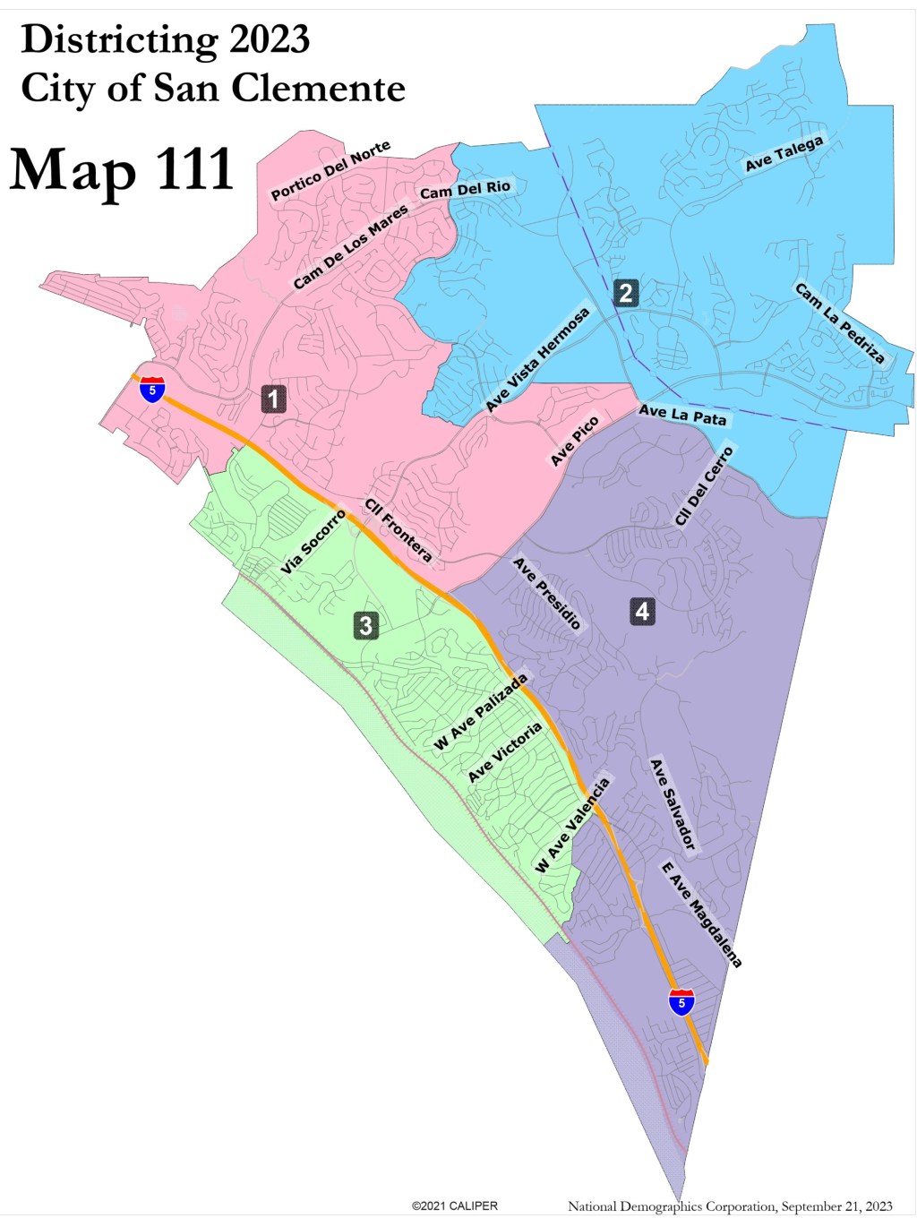
A final district map city officials say will best join together the most similar communities has been selected as San Clemente moves to by-district elections next year following a lawsuit threat arguing minority neighborhoods might not have been getting their share of representation in city elections.
The map sets how the seaside town will be sliced up into new voting districts with each choosing a council member for the dais. The city will also add a mayor seat directly elected by voters in 2026; previously the role was rotated with councilmembers choosing who among themselves would wield the gavel for the next year.
The final map choice by the council, known as Map 111, differs from a previous map that had gotten support in October. Map 111 keeps the city’s central coastal communities west of the 5 freeway together, most importantly for many the Pier Bowl neighborhood.
The new District 3 – Councilmember Rick Loeffler lives in that area now – extends from Shorecliffs on the city’s north end all the way south toward Trafalgar Canyon. The ocean borders the district on the west, the 5 Freeway is on the eastern edge, and the area includes the communities of North Beach, Del Mar and the Pier Bowl.
District 1 goes from the 5 freeway on the west, the Dana Point border on the north, Avenida Pico on the south and Forester Highlands to the east. It is home to Councilmember Victor Cabral, who on Tuesday, Dec. 5, was selected to serve as mayor for the next year. Mark Enmeier will serve as mayor pro tem.
District 2 includes the city’s north eastern communities down to Avenida La Pata on the south – Chris Duncan is the only councilmember from that area.
District 4 is a long, largely inland district that extends south of Avenida Pico and Avenida La Pata to along the town’s southern border with Camp Pendleton and consists of the communities of Rancho San Clemente and the coastal community of Cyprus Shores. Councilmembers Steve Knoblock and Enmeier both live in…
Read the full article here


