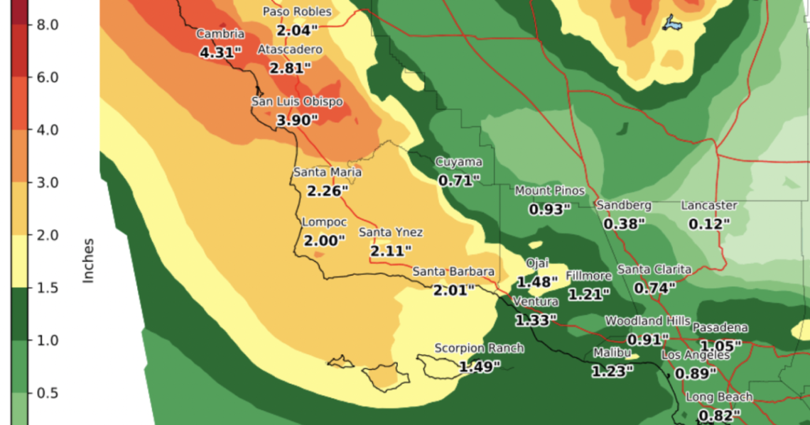
Another storm is making its way into Southern California, where some areas will see rain as early as Thursday night.
How the storm is expected to roll out
Here’s a breakdown of the how the storm will play out across the region according to the National Weather Service.
Here is a rainfall timing and intensity graphic, identifying approximate 6-hour window when we expect varying rainfall intensities. Late Thu-Fri will be heaviest SLO/SBA Counties with Fri-Fri night elsewhere.
Another atmospheric river rain event possible early next week! pic.twitter.com/K9ysoAZFEk
— NWS Los Angeles (@NWSLosAngeles) March 7, 2023
Los Angeles will see light showers across the region and the peak of the rain is expected to hit around Friday evening according to meteorologist Ryan Kittell. Expect some delays while traveling and minor flooding on the roads.
Snow will fall at higher elevations of 10,000 feet and according to Kittell, it’s going to be relatively warm up in the mountains compared to the previous winter storm. That means the average temperatures will be in the 40 degree range rather than dropping to the 20 degree range.
Storm’s origins
This warm storm system comes from the South near the tropics, compared to last month’s winter storm that came from the northern Pacific region.
This warmer rain coming our way creates some issues to watch out for, including snow melt and flooding.
How will this affect mountain communities?
“As that rain hits the snow, you’re gonna get snow melt and runoff from that snow melt. That water doesn’t really have anywhere to go besides between the snow banks,” according to Casey…
Read the full article here


