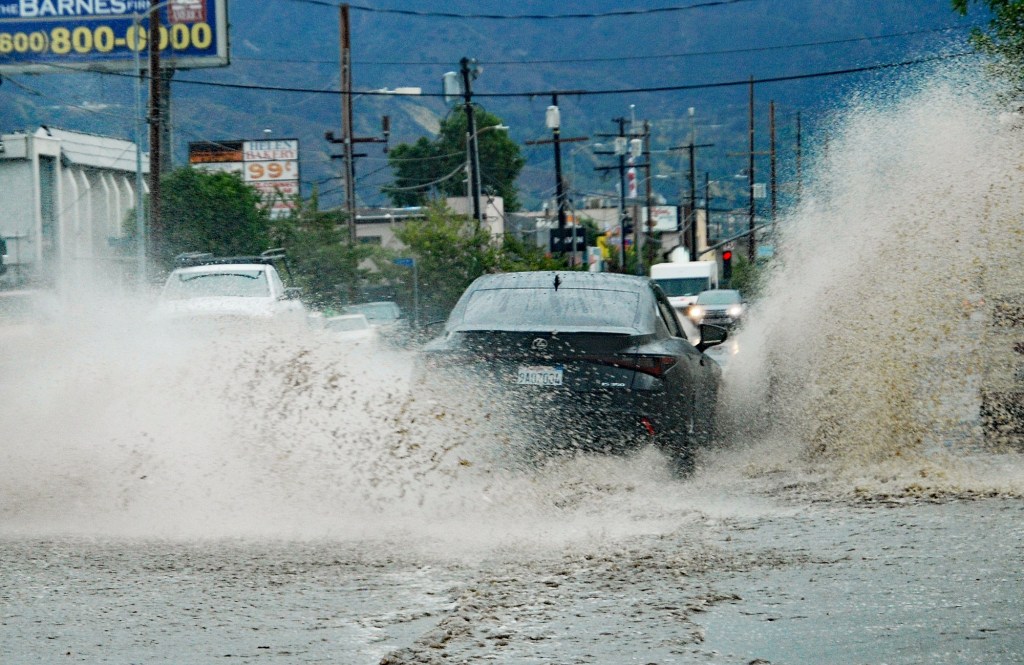
Some parts of Southern California have received more than an inch of rain during the first significant storms of 2024, which are expected to continue across the region during Monday morning’s commute and later Monday.
Meteorologists also anticipate the day could bring thunderstorms and possible flooding, with a flood watch from 9 a.m. to 9 p.m. in place across the Inland Empire and Orange County areas.
Several troughs of low pressure have been sweeping across the region over a roughly three-day period, producing rain and thunderstorms, the National Weather Service said.
“Preliminary rainfall totals through the duration of this event look to be a broad swath of 1-2 inches across the coasts and inland valleys, 2-4 inches across the mountains and roughly .25-1 inch across the deserts,” said a NWS statement.
Forecasters said any major snowfall will be above 7,000 feet during most of the storm series although temperatures may come down enough “for snow to fall down to as low as 5,500-6,000 feet, though any accumulations would be very light and confined to grassy surfaces.”
Highways through the San Bernardino National Forest, including state Route 243 through Idyllwild-Pine-Cove, were expected to remain passable.
Prognostication charts published by the NWS indicated the highest likelihood of thunderstorms is Monday morning and afternoon as the tail end of the last trough trundles eastward.
The weather will start to clear Monday night, followed by mostly sunny and drier conditions going into midweek.
In the Riverside metropolitan area and Temecula Valley, the highs will generally hold in the low 60s for the weekend, with overnight lows in the low 50s.
Rain is expected to continue in San Bernardino County throughout Sunday, with Rialto having seen some of the heaviest rainfall in the area, coming in at 0.75 inches as of Sunday morning. There is a chance of heavier rainfall and thunderstorms on Monday, with highs ranging between 57 to 62 degrees over…
Read the full article here


