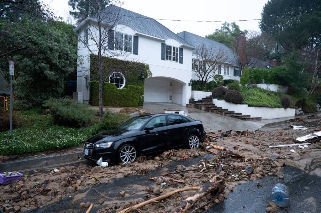
The storm that has drenched Southern California with persistent rain is forecast to expand Monday afternoon, Feb. 5 — to create threats of additional flooding, closed roads and downed trees.
Authorities reported traffic collisions and water rescues as a result of the storm, which is affecting Los Angeles, Orange, San Bernardino and Riverside counties.
The storm mass was centered Monday morning, Feb. 5, over L.A. County.
“It’s been pretty much parked there for the past 12 hours or so,” said Ryan Kittell, a meteorologist in the Los Angeles/Oxnard office of the National Weather Service, Monday morning.
In fact, downtown Los Angeles caught 4.10 inches of rain — blowing away its highest recorded total for any Feb. 4, which previously was a mere 2.55 inches in 1927, according to the National Weather Service.
Kittell said the storm would remain over L.A.. County and grow over Ventura and Santa Barbara counties. He said there would be “very few breaks, if any” in the storm until Tuesday morning.
Monday night, the mountains in San Bernardino and Riverside counties were expected to get heavy snowfall, and then lessening to a moderate rate on Tuesday.
Elsewhere Monday night, Orange County and the Inland Empire’s flatlands were forecasted to get pummeled with rain.
By Tuesday afternoon, showers and thunderstorms were expected, according to the Weather Service.
The hardest-hit areas have been the foothills of L.A. and Santa Barbara counties. The fire station in Topanga had received 10.38 inches of rain since Sunday, Kittell said. Downtown Los Angeles had received 5.34 inches in that period.
Two days ago, the Weather Service was predicting that Santa Barbara County would get the most rain, but Kittell said Los Angeles County is now in line to receive the most.
The storm was also expected to expand into San Diego County.
In San Bernardino County, the middle fork of Lytle Creek had received 7.22 inches in the 24 hours before 4:30 a.m. Monday. Orange…
Read the full article here


