Los Angeles County hasn’t reached the peak of its expected rainfall, but the National Weather Service issued a severe flash flood warning Friday afternoon amid already-heavy showers sweeping the region.
Issued shortly after 2 p.m., the alert applies to the more northern areas of Los Angeles County, like the San Fernando Valley and communities in the foothills of the Santa Monica and San Gabriel mountains, according to NWS meteorologist Ryan Kittell.
Under a flash flood warning, the NWS advises moving toward higher ground and avoiding burn scar areas, which become especially dangerous during heavy rainfall. Burn scars create vegetation that resists water penetration, Kittell explained, meaning water can flow fast and “like concrete.” As the water flows rapidly, it can also bring debris and other hazards along.
If you’re stuck inside, move to a second story or the highest place inside your home, the NWS alert said. The Los Angeles Fire Department is also offering sandbags at local fire stations, which can assist with diverting debris and stormwater away from homes.
Driving in a flood is the leading cause of death during these weather events, the NWS added.
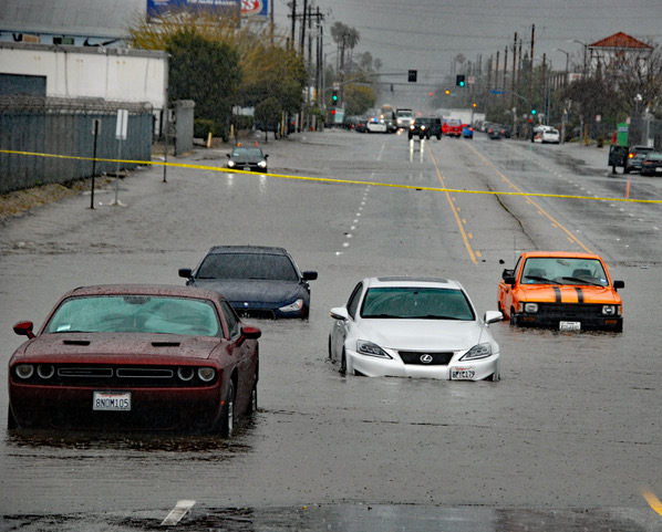
The California Highway Patrol reported roadway flooding on the 5 Freeway at Lankershim Boulevard near Burbank and Sun Valley.
This isn’t the LA river, it’s the 5 freeway through Burbank/Sun Valley right now.
Cars floating about. Water spilling over the median wall.
Don’t drive unless you have no choice.#SoCalStorm pic.twitter.com/jG5HPazrBC— Christian Lanz🎙 (@ChristianLanz) February 24, 2023
Kittell said the alert will be valid until 10 p.m., although the peak rainfall is expected shortly after midnight and into Saturday morning.
So far, 1.5 inches to 3 inches on average have fallen in areas within the flash flood warning, Kitell said.
If more rain comes as projected, he said it’s likely another alert will be issued.
“The peak of the storm hasn’t even occurred,” Kittell added….
Read the full article here


