It’s chilly and windy…again.
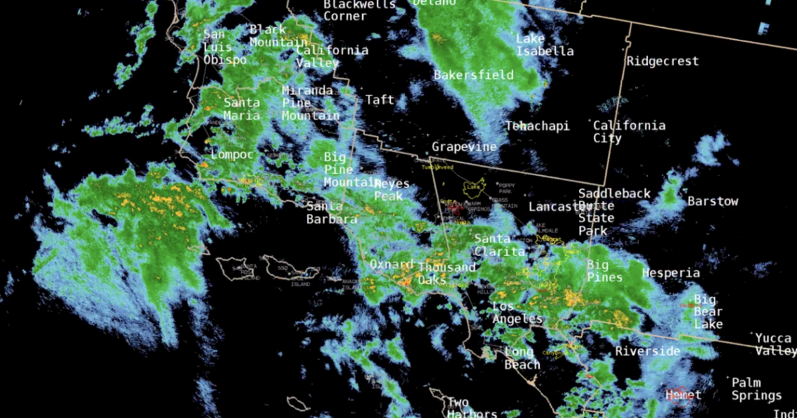
The National Weather Service reports that today (Wednesday, March 1) is the last day of this weaker storm system. Most of the heavier rain passed through overnight. We can expect some light showers across Los Angeles County until noon.
If you haven’t already, now is a good time pull out those stylish windbreakers you may have picked up at thrift store, or borrowed from a relative’s closet who flashed them around in the 80’s — it’s going to be fairly windy.
Antelope Valley will see gusts up to 35 mph and the mountain areas will see wind speeds reaching up to 50 mph, according to John Dumas with the National Weather Service.
“We’re expecting strong, west winds, along with this storm, and it’s also pretty chilly out there. We’re gonna have another day with below normal temperatures, once again, not getting to 60 today,” said Dumas.
Yes, we’re in a cold streak
The last of a series of cold fronts will impact the region through Wed w/ rain & snow w/ low snow levels by Wed. Some mountain roads will likely be dangerous with road closures possible, including I-5 north of Santa Clarita and hwy 14 near Acton. pic.twitter.com/0No02OGbC9
— NWS Los Angeles (@NWSLosAngeles) February 28, 2023
That means Wednesday marks the eighth day in a Los Angeles County cold streak that hasn’t seen temperatures higher than 60 degrees.
The last time the area saw an 8-day cold streak was back in 2005. But the longest record for a cold streak was back in 1949 when temperatures stayed below 60 degrees for 20 days. (20 days!)
More snow today
And, there’s going to be more snow for today.
Snowfall will continue…
Read the full article here


